|
I am a Post-Doc at the LIRIS laboratory (LIRIS) in the Origami team. XR Outdoor - Urban Mock-up - 3D urban data - Temporal representation - XR Visualisation Email / CV / GitHub / Youtube Chanel / Google Scholar / ORCID |
|
| Publications | Scientific promotion | Teaching | Responsabilities | Experience | Hobbies |
|---|
|
|
|
Director : Gilles Gesquiere Co-director : Johanna Delanoy Jury : Christophe Jouffrais, Mathieu Brédif, Myriam Servières, Valérie Gouet-Brunet, William Puech |
|
Representative papers are highlighted. See Google Scholar for an up-to-date list. |
|
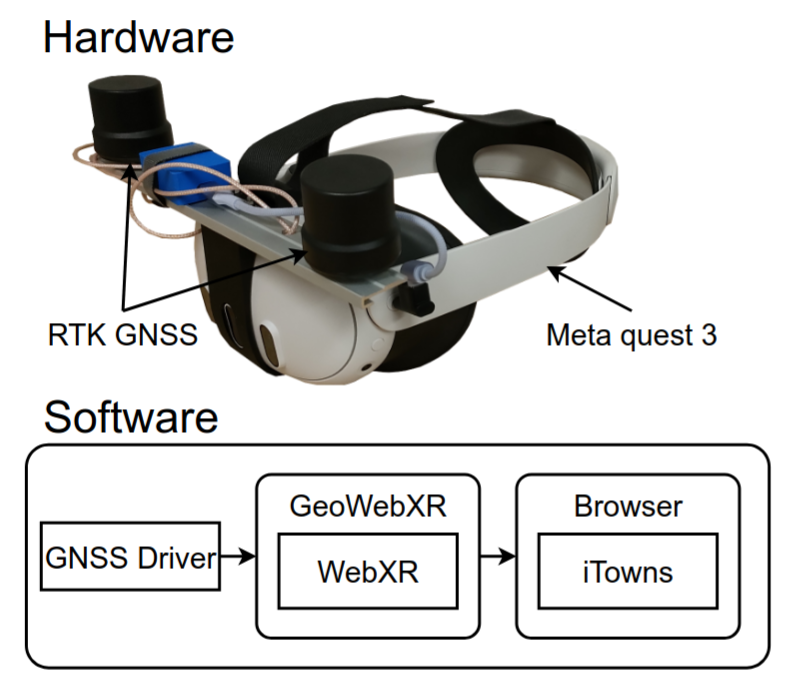
C. Gautier, M. Brédif ISPRS Annals of the Photogrammetry, Remote Sensing and Spatial Information Sciences, 2026 paper | video |
|
C. Gautier Thesis manuscript, Université de Lyon, 2025 paper |
|
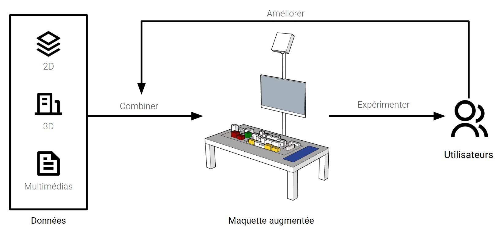
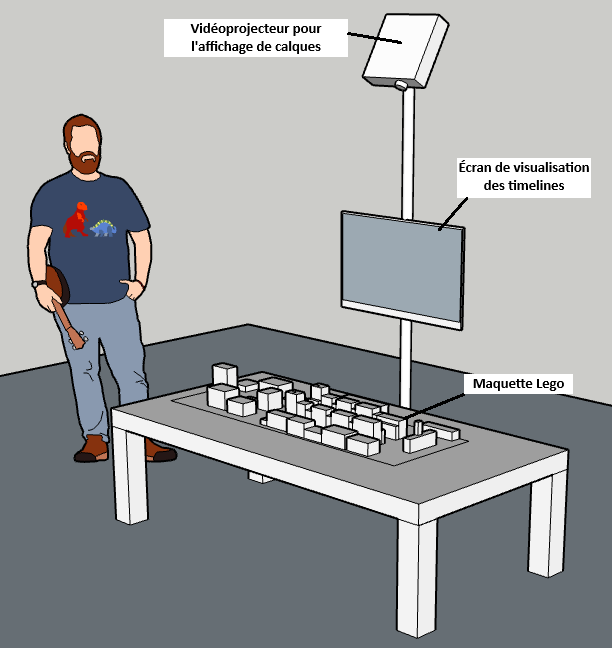
C. Le Bihan Gautier, J.Delanoy and G.Gesquiere Les journées Françaises de l'Informatique Graphique 2024 paper | project page | video |
|
C. Le Bihan Gautier, J.Delanoy and G.Gesquiere Pacific Graphics 2024 paper | project page | video |
|
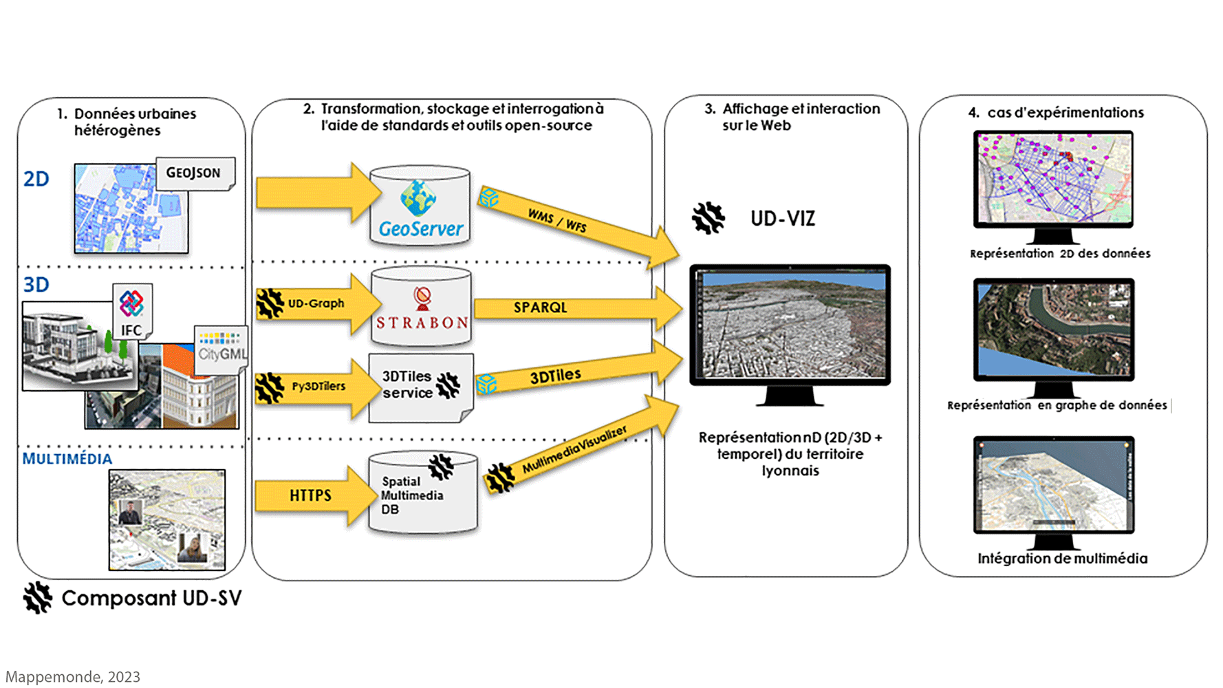
C.Colin, C.Gautier, D.Vinasco-Alvarez, J.Delanoy, G.Gesquière, J.Samuel, S.Servigne, É.Boix, T.Dupont, M.Livebardon, V.Machado and L.Marnat Mappemonde 2023 paper | project page | demo |
|
C.Gautier, J.Delanoy and G.Gesquiere IV 2023 paper | project page | video |
|
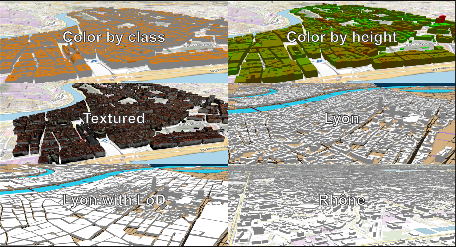
C.Gautier, J.Delanoy and G.Gesquiere 3DGeoInfo 2022 paper | project page | demo |
|
L Marnat, C Gautier, C Colin, G Gesquière 3DGeoInfo 2022 paper | project page | demo |
|
|
|
|
|
|
|
|
I love hiking and skiing and i beggin wood sculpting recently. |
|
LASTIG/Geovis email: corentin [dot] gautier [at] ign [dot] fr |
|
Email / CV / GitHub / Youtube Chanel / Google Scholar |
|
Website template stolen from Jon Barron. |